Back to school during COVID-19: Why location matters
By Dr. Alexander Watts, Esri Canada
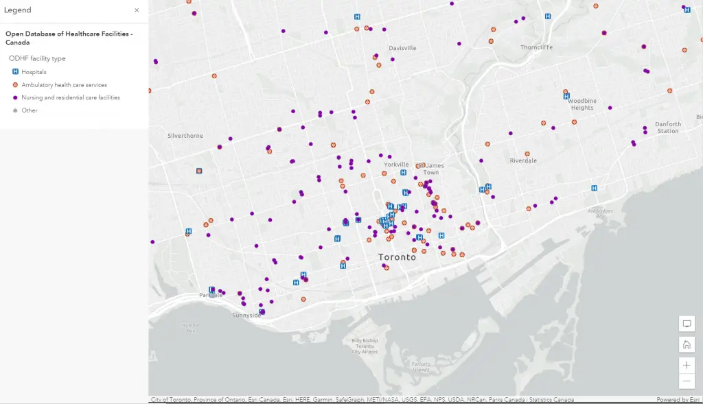
Visualizing school locations with COVID-19 risk factors can enhance surveillance and intervention strategies at the neighbourhood level.
In this story map, we demonstrate how layering socio-demographic and epidemiological data with school locations in a map can help elucidate where public health practitioners should focus their surveillance and health promotion efforts this fall. Contextualizing risk factors in school neighbourhoods is fundamental to timely action in case of sporadic COVID-19 outbreaks. We use the Toronto region as an example to illustrate the value of aligning location-based data at the neighbourhood level.
To learn more about why location intelligence is critical to future public health planning, attend my presentation Mapping out Canada’s digital public health future at HIP Week Live 2021: Futureproof on Monday, Oct. 4 at 1 p.m. ET.