
How Esri Canada makes geospatial health data easy to find and use
By Kieran Petrasek, Health Geography Lead, Esri Canada
Up-to-date, authoritative, and multi-regional health data can be hard to find. Even though technological innovations allow us to collect more data than ever before, and open data is increasingly widespread, these datasets often lack location information or, even if georeferenced, may be limited to a single jurisdiction.
This is a problem because understanding ‘where’ health variables occur is central to how we prioritize public health interventions, mobilize resources, and administer care in a timely manner.
Esri Canada is making it easy for health information professionals to find and use pre-cleaned, multi-regional, and authoritative geospatial health data. In this post, we highlight three data sources maintained and updated by Esri Canada: The Living Atlas, Community Map of Canada, and data built by Esri Canada partner Environics Analytics. With these tools at your disposal, you should be well-positioned to utilize GIS in your everyday work.
The Living Atlas of the World
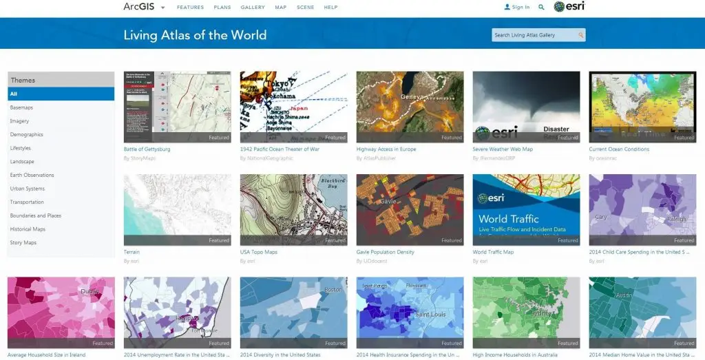
Esri’s ArcGIS platform includes the Living Atlas of the World, the foremost collection of geographic information from around the globe and curated to ensure that it originates from authoritative sources and is well documented.
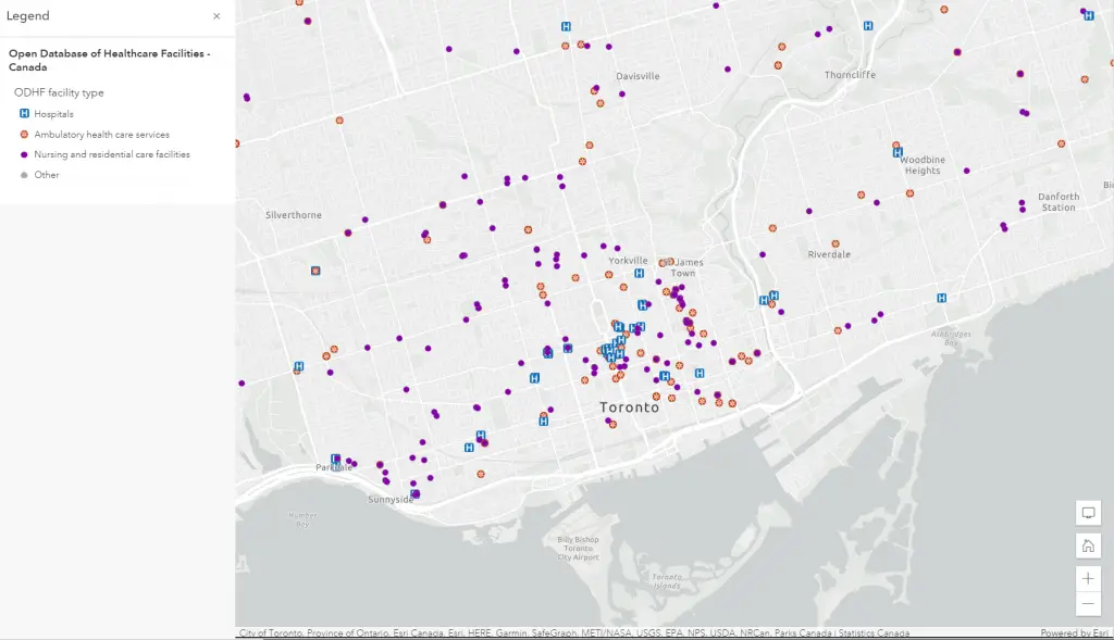
There are hundreds of global health-related web maps, apps and layers in the Living Atlas, and dozens that are specific to Canada. For example, the Open Database of Healthcare Facilities (ODHF) is a collection of open data containing the names, types, and locations of health facilities across Canada. The inputs for the ODHF are datasets whose sources include regional health authorities, provincial, territorial and municipal governments, and public health and professional health care bodies.
The Community Map of Canada
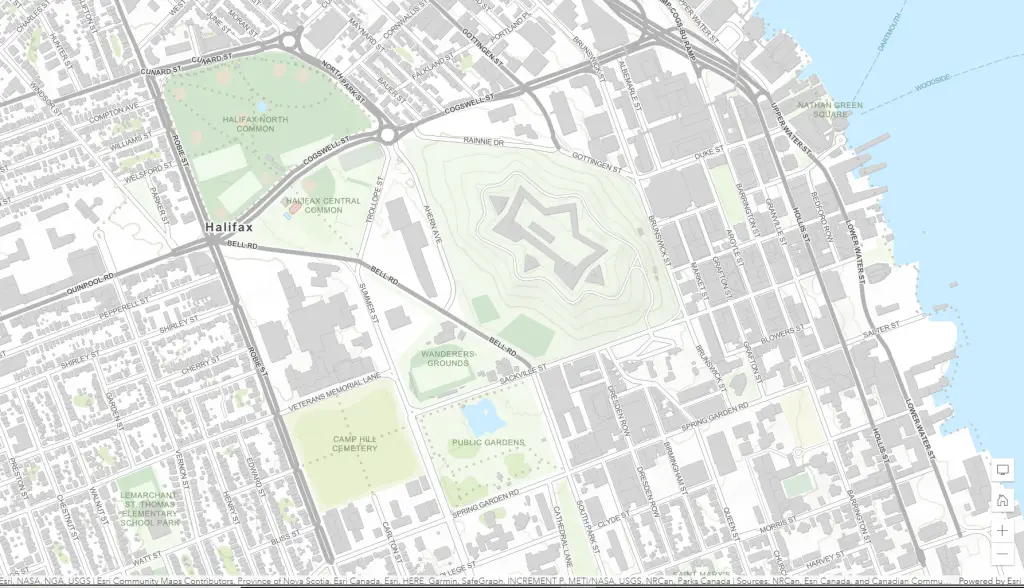
The Community Map of Canada is a basemap of Canada built from authoritative data, collected closest to source and updated daily. Seamlessly created to one common specification and compliant with international standards, it provides unrestricted access to community maps and imagery across the country. For health information professionals, there are a couple of main benefits to using the Community Map:
- Improved planning strategies: This basemap data allows users to augment decision support and analysis with your existing health data based on reliable data that is location-referenced. You can therefore reduce operational redundancies by leveraging the productivity from the community – essentially, using the best available spatial data out there without having to find it yourself!
- Greater consistency: Drawing from a common basemap dramatically reduces discrepancies that may otherwise lead to critical errors—a single source of truth promotes understanding and furthers collaboration and community. The Community Map of Canada is updated daily, so you can always be sure that your maps will be as up to date as possible.
- Free and easy access: You can save time and resources in developing basemaps by using already available high-quality versions. If you are Interested in contributing your own maps, Esri will pre-process and host your data at no cost to you!
While most of the data in the Community Map is not explicitly health-related, it forms the backbone of geospatial infrastructure which enables real geospatial health analysis to occur. Roads, hospitals, emergency services – all these features and more are available in the Community Map.
Environics Analytics Data
Esri Canada has formed a strategic partnership with Environics Analytics (EA) to provide multiple geospatial health datasets and hundreds of variables to our users. The data is available for users to license through our agreement with EA, use GeoEnrichment in ArcGIS solutions, or as an add-on through EA and our reseller agreement. What’s more, ArcGIS Business Analyst (Canadian Edition) incorporates this data in one powerful, flexible package.
There are two particularly powerful geospatial health datasets available from EA I would like to highlight, both available at postal code geographic resolution:
- CommunityHealth. Administered by Statistics Canada, the Canadian Community Health Survey (CCHS) collects detailed information on the health status of Canadians. CommunityHealth takes the latest available survey data from the CCHS and provides 491 variables to better understand Canadians based on health-related topics, including their ailments, health care utilization, self-esteem, body mass index and fitness level.
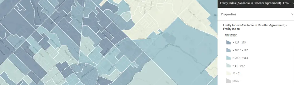
- The Frailty Index identifies Canadians by neighbourhood who are more likely to have difficulty going about day-to-day activities in their communities due to age, physical limitations or health, especially conditions that are comorbidities of concern for COVID-19. The frailty index is largely a picture of senior populations across Canada.
For more information on the Living Atlas of Canada, Community Map of Canada and Environics Analytics Health data, or how to access this data using ArcGIS, please contact us at publichealth@esri.ca.